Willem Jansz. Blaeu.Around 1630 a new atlas publisher appeared on the scene; Willem Jansz. Blaeu. With him a new trend in Amsterdam atlas production began, characterized by competition and increase in the number of maps.The history of the successive publications is extremely complicated and falls beyond the scope of this article. Suffice to say that the quality of the maps grew thanks to the increase of the competition. The oldest son of Hondius, Jodocus jr., had taken over the production of atlases and the management was taken over by younger brother Henricus, in about 1620 The relation between the two brothers was obviously not good, since the eldest conceived the plan of bringing a new atlas onto the market by himself. He had around 40 new maps engraved in copper for the purpose, but died before he could execute his plan. One way or the other, Willem Jansz Blaeu laid hand on the copper plates of Jodocus before his brother Henricus and his brother in law Johannes Janssonius could. Blaeu entered the atlas market and became a competitor. Blaeu produced a new map and called his new atlas: Alantis Appendix, sive pars altera (Supplement to the Atlas). The word Atlas referring to that of Mercator.
After that the situation becomes complicated, since Henricus and Johannes wanted to publish a supplementary atlas as soon as possible. In March 1630 they gave the order to replace the missing plates. The new ones were true copies of the originals, since they were made by the same engravers. The result of all this competition was that Blaeu produced a two-volume atlas (around 210 maps) in four languages, Hondius and Janssonius made an atlas in three volumes with around 320 maps (1638) Willem Jansz. Blaeu died in 1638 and his son Joan Blaeu succeeded him.
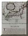
Joan decided to shunt off the head start which Janssonius enjoyed with his Novus atlas absolutissimus from 1658. Joan Blaeu's Atlas Maior sive Cosmographia Blaviana, published in 1662, was the most prestigious book and the "greatest and finest atlas ever published". In these series of atlases he also produced the Novus Atlas Sinensis by Martinus Martini, published by Joan Blaeu in Amsterdam around 1655. In this we find the following map: On the back a description of Korea is printed. Since nobody really knew what Korea and Japan looked like, the map makers busily copied from each other or added some details which they received from British or Dutch sailors.
Martinus Martini.Martinus Martini, was born in 1614 in Trente and lived since 1643
in China, where he died on June 6, 1661. With four other Jesuit priests
he arrived in June 1642 with the English ship "de Swaen"
from Goa to Bantam and sent from there to G.G. van Diemen with a letter
written in Latin (which was delivered at June 18, 1642 in Batavia)
in which he requested to give passage to Macassar, Siam, Cambodia
or the empire of Tonkin in order to reach China and Japan." This
letter was sent to the opperhooft (chief) of Nagasaki to hand it over
the the Regents of "Nagasacqui" or the commisionaries. "Martin
Martini was sent to give informations to the Holy See; to his influence
and abilities it is due that Alexander VII decreed in a manner perfectly
contrary to the former Edict [with which some doctrines of the jesuits
were condemned as heresy] While on his journey the great traveller
passed Batavia.....
After the death of Johannes Janssonius in 1664 and Joan Blaeu in 1673 the Dutch cartography was already in decline. To part 5: Hendrick Hamel.
|


